
The short answer
For a drone vs surveyor choice at an aggregate quarry, the drone wins on repeat stockpile volume counts and bench mapping, which a crew can only cover on foot at a high cost in hours. A surveyor still wins on legal boundaries, control points, overhangs, and any area a flight cannot see, so most sites end up using both. A drone makes sense when counts repeat often enough to pay back the setup, and it does not make sense as a replacement for ground work.
Key takeaways
- A drone pays off on repeat stockpile volume counts, not on one-off boundary or control work.
- A 2022 Malawi quarry study found 2.6 percent drone volume error against 1.3 percent for traditional survey, both under a 3 percent maximum allowable error.
- Vendor case studies report about 20 man-hours of ground survey shrinking to about 2 hours of aerial work on one 1,400 acre site, which needs testing on your own pile.
- The surveyor's hours move toward control, checks, and overhang areas, and a trained person stays on the job.
- Start with one pit and a site assessment, then compare the lease quote against the surveyor hours it would move.
Drone vs surveyor at aggregate quarries: which makes sense?
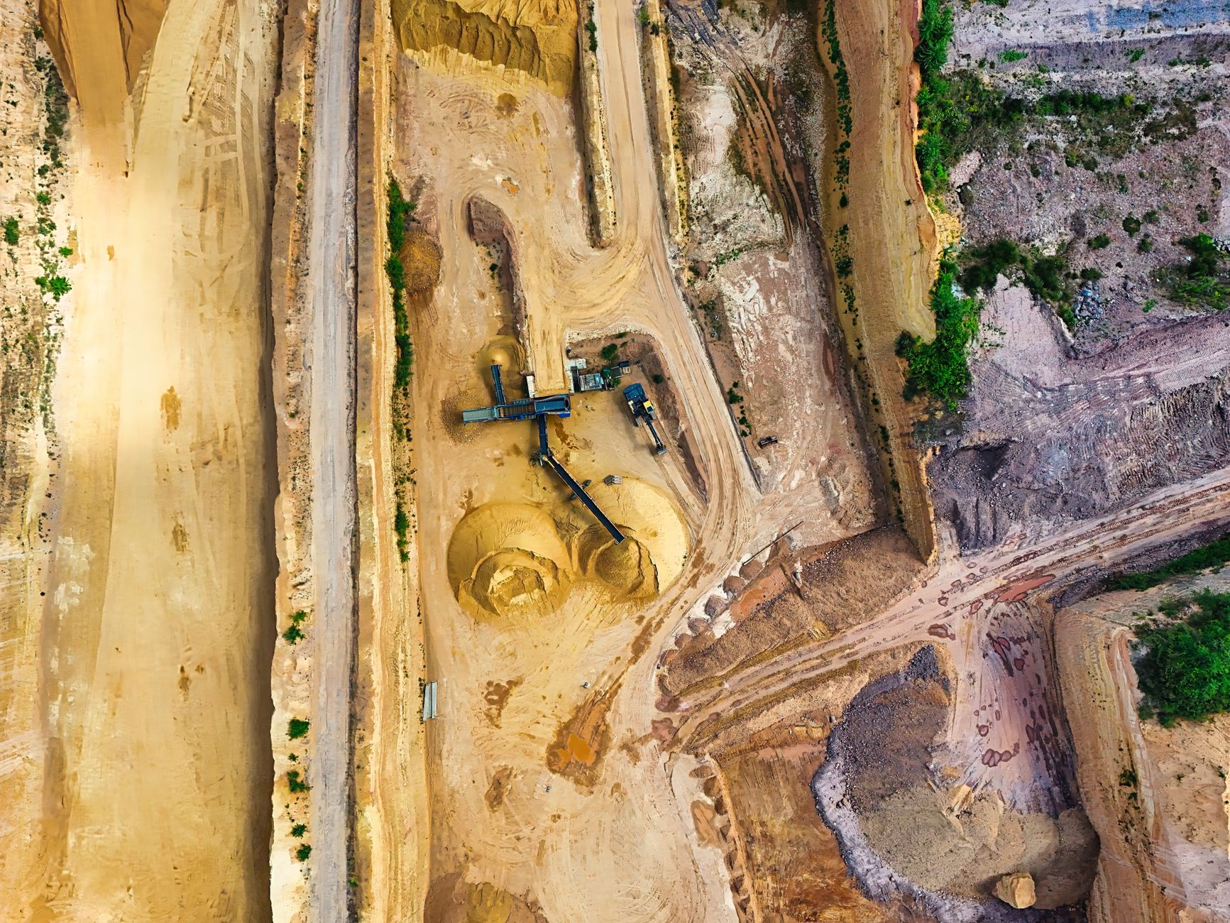
Most aggregate quarries count stockpiles by sending a surveyor onto the pile with survey equipment, walking the top and edges, and turning the points into a volume. That method works, but it ties up a crew for a large part of a shift each time, so many operations count less often than the material actually moves. A drone flies a repeatable set of photo passes over the same piles and benches, and software turns the images into a surface and a volume.
A drone makes sense when the job is repeat volume counts on open piles and benches, when crew time spent walking piles is the bottleneck, and when a trained pilot can fly on a schedule and keep records. It does not replace legal boundary work, control networks, or ground points in places the camera cannot see. So the drone vs surveyor choice is rarely one winner: the drone takes the repeat counts, and the surveyor keeps the work that needs a person on the ground.
The base of sites is large. A NIOSH fact sheet built on MSHA data counted 7,178 sand and gravel mining operations reporting employment in 2006 and 3,549 crushed stone mines that year, with sand and gravel at 48.2 percent of all mining operations. Those are the newest counts I could verify, and they are old. A 2025 Connecticut General Assembly report counted 44 active surface mines in that state, about half for construction sand and gravel. USGS puts crushed stone producer sales or use at about 1,550 million metric tons in 2023 and an estimated 1,500 million in both 2024 and 2025.
What does a surveyor actually do in a quarry shift?
A surveyor on a quarry job typically sets up on a known control point, then shoots points across the stockpile top, toe, and any haul road or bench that affects the count. The shift is shaped by safety briefings, access to the pile while loaders and trucks are working, and weather. Once on the pile, the walking and shooting can take most of the crew's time, and the points still need processing into a volume and checking against the last count.
The surveyor also carries work that a volume count does not touch. That includes boundary checks, setting and checking control, as-built checks on new cuts, and grade questions from the pit. Those tasks need a qualified person, judgment about the ground, and records that a photo pass alone cannot produce. A volume count is one task in a broader survey role, so the labor comparison has to look at the whole week, not only the stockpile day.
This matters for the decision. If the stockpile count is the main reason the survey crew is on site, a drone can move a large share of their hours. If the crew is mostly doing boundary and grade work, a drone adds a tool but does not free many hours. Check your timesheets before you assume either.
- Route and coverage
Drone
Same photo route each time over the pile and benches
Surveyor
Walks the pile and shoots points, so the route can vary with the crew
- Hours per count
Drone
Flight plus processing, which vendor figures put well below a ground count
Surveyor
Crew time on site plus processing and checks
- Under overhangs and in tight bins
Drone
Cannot see hidden faces
Surveyor
Can reach areas on the ground, with safety controls
- Boundaries and control
Drone
Does not establish legal boundaries or control
Surveyor
Does this work and signs off the count
- Weather
Drone
Wind, rain, fog, and low light can ground a flight
Surveyor
Can often keep working when a flight cannot
- Judgment about the ground
Drone
Reads images only, so a person must check results
Surveyor
Reads the pile in person and catches what the images miss
Can a drone take over stockpile volume counts?
For the photo pass and the volume calculation on most open piles and benches, yes. The flight covers the same area each time, so a change from one month to the next reflects the pile rather than a different walking route. Accuracy is the first question a quarry manager asks, and the research is limited but useful. A 2022 study by Matsimbe and colleagues, published in Frontiers in Built Environment, measured drone volume error at 2.6 percent against a known stockpile volume at a quarry in Malawi. Traditional survey on the same pile came in at 1.3 percent, and both sat under the plus or minus 3 percent maximum allowable error the authors cite.
A 2021 paper by Ajayi and Ajulo on a quarry in Estonia gave a reference volume of 2750 cubic meters. The drone estimate was 2686.252 cubic meters, and the ground survey estimate was 2830.713 cubic meters. Neither method was perfect, and neither was automatically right. Both studies cover one site each, so they show the method can work in those cases, not that every quarry will match. Test the drone against a pile whose volume you already trust before you rely on its counts.
The practical point is that the drone's value sits in consistency. Repeat flights over the same route give a series you can trend, while occasional ground counts can vary with who walks the pile and where. That consistency matters more than any single headline accuracy number.
How many hours does a volume count take?
Hours are why most quarries look at drones. In a vendor case study of an Ontario quarry covering about 1,400 acres, the ground survey took about 20 man-hours, while the aerial survey took about 2 hours including flight and data extraction. That is a vendor source for one site, so treat it as a test target rather than a benchmark. Pile size, access, and the amount of ground control you still need all change the result.
Other vendor-reported figures point the same way at smaller scale. A trade case study of six quarries that switched from ground to bi-annual aerial surveys reported 228 man-hours saved per year. A drone vendor case study of one stockpile reported about 45 minutes by the previous method and about 7.9 minutes by drone. None of these was measured independently across many sites, and none tells you what your crew will save.
The right way to use these numbers is to time your own count. Log the crew hours for one ground count, fly the same pile once, and compare the total hours including processing and checks. That gives you a figure for your site, not a vendor's.
What do the labor numbers say about turnover and staffing?
Public data does not give a clean quarry-level picture of turnover, overtime, night shifts, or sick days. I could not verify a quarry-specific figure for any of those in this research, so treat unsourced claims with caution. What the public figures do show is the labor market around the job. The Bureau of Labor Statistics projects surveyor employment at 56,100 jobs in 2024, growing 4 percent from 2024 to 2034, a net gain of about 2,500 jobs. Demand for qualified surveyors is growing steadily, not sharply, so filling a vacancy takes planning.
For turnover across all industries, the BLS Job Openings and Labor Turnover Survey reported total separations of 3.3 percent for 2025 on an annual average, unchanged from 2024. Quits were 2.0 percent and layoffs 1.1 percent. That is an all-industry figure, not a mining one. The annual mining rate did not come through in this research, so pull the mining rows from the latest JOLTS tables before you put a turnover rate into a staffing plan.
Count work is normally done in daylight, so night shifts rarely come into the comparison. Overtime can cluster when material demand peaks and the crew is stretched across several jobs, which is when a stockpile count is most likely to slip. Track overtime and missed counts on the surveyor's calendar for a season, and you will learn more about your own labor pressure than any national average can tell you.
How does a team work with a drone and fewer survey hours?
The right setup keeps a person on the job at every step. A trained pilot, often the surveyor or a site technician, flies the same route each time, checks the images, and hands off the model. The surveyor checks the volume against control and ground points, reviews outliers, and signs off the count. Nobody is removed from the process. The hours move from walking the pile to checks, control, and the areas a flight cannot cover.
The gain shows up when counts run more often than the crew can manage. A quarry that counted only as a crew allowed might move the routine count to a drone, keep a surveyor on a periodic ground check, and return the crew to boundary and grade tasks. That is a change in how hours are spent, not a move to zero staff. A site with no trained person on hand is not ready for this model, and training should come first.
What can a drone not do at a quarry?
A drone cannot establish legal boundaries, and it does not replace the control network a survey depends on. It sees the top of a pile well and the open faces of a bench reasonably, but it cannot see under an overhang, into a narrow undercut, or behind a wall that blocks the view. Piles under cover, in tight bins, or pressed against a wall need ground work. Heavy wind, rain, fog, and low light can ground a flight, so a fixed-date count may slip while the crew can still work.
Airspace and site rules set limits too. A quarry near an airport, a restricted zone, or a site with other rules may limit flight, and those limits are local, so check before you plan a schedule around flights. Safety is another limit. Pile work is a known injury risk. A trade publication reported NSSGA's preliminary figure of 1.74 injuries per 200,000 hours worked for 2017, the 17th straight year of improvement. That is an old figure, and I did not verify a current industry-wide rate. NSSGA's 2025 safety awards, announced in September 2025, go to sites with a consecutive period without an MSHA-reportable injury, which is a useful benchmark to ask about.
A drone can reduce the time people spend on steep faces for some counts. It does not remove the surveyor from the site, and it does not remove the need for trained people to read the results.
How do you start a drone program at a quarry?
Start with one pit and one pile type, not the whole quarry. Pick a stockpile count you already run, fly it alongside the existing survey for several cycles, and compare the two volumes against a known reference or a checked pile. If the drone holds up, expand to more piles. If it does not, you have found the limit at small scale, and the surveyor keeps the job.
Before you commit, settle the questions that change the answer: what the piles look like, how often you count and why, who will fly and keep records, and how the reporting feeds your planning. Those answers come from a site visit, not a desk estimate, and they decide whether a drone fits at all.
We pick the right robot for the site, lease it through financing, deploy and integrate it, train staff and service it nationwide. The lease quote comes after a free site assessment, so start there. Compare the quote against the surveyor hours it would move, not against the aircraft alone.
Frequently asked questions
Want a drone at your aggregate quarry?
Tell us about your site. We will recommend the robot, quote the lease, and keep it serviced.
Sources
- NIOSH mining statistics fact sheet based on MSHA data
- Connecticut General Assembly report 2025-R-0140
- USGS Mineral Commodity Summaries 2026, crushed stone
- BLS Occupational Outlook Handbook, surveyors
- BLS JOLTS news release, July 29 2025
- Matsimbe et al. 2022, Frontiers in Built Environment
- Ajayi and Ajulo 2021, Quaestiones Geographicae
- NSSGA 2025 Safety Award recipients