
The question, in the buyer's words
Our port has two miles of wharf over tidal water where pilings corrode out of sight, and divers only check them every few years; could drones fly the wharf deck and flag cracked or corroded piling tops before a heavy crane load?
Key takeaways
- A drone screens the wharf deck and exposed pile tops for visible damage, but it does not measure steel thickness or see submerged metal.
- The guidance summarized in a 2020 marine construction trade article calls for annual above-waterline piling inspection, so drone visits can add coverage between diver dives.
- Bridge rules set an underwater inspection limit of 60 months, a useful reference for how long submerged piling can go without a look.
- Drone time savings are not guaranteed: a 2023 New Mexico State University study found UAV assisted inspections took about twice as long as traditional ones.
- Use the drone result to decide where divers and remote vehicles go, and keep a written rulebook for what each finding triggers.
Can a drone check port wharf piling corrosion from the deck?
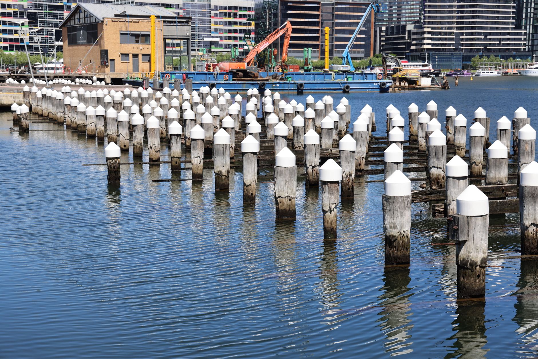
A drone flying over a wharf can see the deck, the pile caps where piles meet the deck structure, and the upper section of each pile that stands clear of the water. It can photograph cracks in concrete caps, spalling around pile connections, rust bleeding from steel and loose or missing bracing above the tide line. These are the defects a camera reads well, and they are the ones that tell an engineer where a pile may have lost section.
What a camera cannot read is wall thickness. Measuring how much steel is left in a pile takes contact or electromagnetic methods, and the zone that matters most for corrosion, the splash and tidal zone, is only partly visible even at low tide. Federal bridge research on unmanned aircraft, FHWA-HRT-21-086 from September 2021, covers sensor standards and field testing for exactly this reason: the sensor decides what a flight can prove. A Minnesota DOT presentation for an FHWA program said off the shelf drones have limited inspection capability and can supplement but not replace a full inspection.
Keep drone findings in terms the diver team can use. Mark each pile by position, photograph it from a fixed distance, and record the tide height at the time of the image. That turns a flight into evidence the people deciding whether a pile is sound before a heavy lift can act on.
How often are piling inspections required?
There is no single national rule for port wharf piling, so the schedule usually comes from owner policy, engineering guidance and the requirements of insurers and lenders. The guidance summarized in a 2020 marine construction trade article, which cites NCEL guidance dated to 1986, calls for piling above the waterline, including splash and tidal zones, to be inspected annually. It sets timber members to be inspected at least every 3 years. The currency of that 1986 guidance was not confirmed in our review, so check it against your own design records.
The underwater interval is left to the inspection type and the expected rate of deterioration, and the trade article gives no number for it. Bridges offer the closest analogy for submerged members. The Massachusetts bridge inspection manual says underwater inspections are generally every 36 months and must not exceed 60 months, which tracks the federal baseline of 60 months in 23 CFR 650.311. A May 2022 federal final rule, as summarized by secondary sources, allows underwater elements to go up to 72 months with written FHWA approval.
For a wharf, that means submerged piling can go years between direct looks unless you set your own interval in writing. A drone does not change the underwater clock. It can shorten the gap in what you know about the above-water and splash zone members, which is where the annual guidance already applies.
Why do diver checks miss so much corrosion?
Diver inspection is the traditional method for submerged piling, and its weaknesses are the reason drones and remote vehicles are being tested. A 2025 IEEE research paper described in our search notes states that pile inspection by skilled divers is subjective, inaccurate, time consuming and costly. The same paper describes remotely operated vehicles evaluated on two steel sheet pile wharves, with remote eddy current thickness mapping for members at or below the waterline.
The practical lesson is that a diver visit every few years samples a wharf on one day, in one tide, under one set of visibility conditions. Visibility, surge and tide all change what a diver sees. A drone flight over the deck and splash zone gives a wider and more repeatable sample between dives, and it gives divers a ranked list of piles to inspect instead of a blind walk along two miles of wharf.
Assign each tool one question. The remote vehicle answers thickness, the diver answers close contact questions, and the drone answers coverage. Mixing those up is where inspection programs lose time and where important piles get missed.
How much time does a drone survey really save?
Be careful with speed claims. A 2023 New Mexico State University study, listed in the USDOT ITS Knowledge Resources database, reported that UAV assisted inspections took about twice as long as traditional inspections. The record attributes part of that to drones reaching piles and elements that were otherwise hard to access, so the drone added coverage rather than cutting hours. Check the database record for the study's exact identity before you cite it internally.
The Mountain Plains Consortium projected that an automated UAV system could finish a bridge inspection in about two hours on site, against about two weeks for a human inspection, though traffic control would still be needed. That is a projection, not a measured result, and a bridge is not a wharf. Ask any provider for the test data behind a time claim, and ask whether the time includes flight planning and post flight review.
For a port, the time question is really a tide question. A survey of the splash and tidal zone has a window of a few low tide hours, and a drone can fit that window easily. A diver crew needs its own mobilization and surface support, so the window often decides which crew can go, not the other way round.
Where does a drone fit in a wharf inspection program?
A drone works best as a screen. It covers the whole deck and every reachable pile top quickly, then ranks what needs a closer look. Oregon DOT research SPR 787, published in February 2018 as FHWA-OR-RD-18-11, tested drone inspections on six bridges and three towers and reported a benefit cost ratio of 9. That suggests screening can pay back, though the work was on bridges and towers rather than wharves.
A workable cycle for a two mile wharf might look like this: a deck and splash zone flight after each major storm or before heavy crane operations, a ranked list of flagged piles, then divers or a remote vehicle on the flagged set plus the scheduled full inspection. The drone does not replace the scheduled dive program. It tells you where the scheduled dives should go, and when a pile needs a look before a lift.
Set the trigger rules in writing before the first flight. Decide which defect types send a pile to a diver, which send it to engineering review, and which are only logged. A drone flight without that rulebook produces photographs that nobody acts on.
When is a drone the wrong tool for wharf piling?
Drones are the wrong first tool in several cases. If the question is steel thickness, a drone will not answer it, and an eddy current or ultrasonic survey is the right next step. If a pile sits under a crane's working area, the flight has to be planned around lifting operations and may need a hold. If wind, fog or heavy spray keeps the aircraft grounded on the days you need it, the schedule slips, so plan for those days.
Drone flights are a poor fit in these situations:
- Submerged members, where a drone sees only the water surface.
- Thickness and section loss, which need contact or electromagnetic methods.
- Flights over live lifts or within a load's swing and drop zone, which need a stop and hold procedure.
- Piles hidden behind a deck or structure that blocks the camera view, where a drone adds little.
- Sites where port operations or airspace rules do not allow flight near active work, which need approval before any other step.
What does port context tell an engineer about waterfront risk?

The 2025 ASCE Infrastructure Report Card gave ports a B, up from a B minus in 2021, and gave inland waterways a C minus, up from a D plus. The overall national grade was a C. A national report card is an average and says nothing about your wharf, but it shows that waterfront assets are a concern for federal planners as well as local owners.
How many ports exist is hard to pin down. We did not find a current national count, so treat any older figure as a rough scale rather than an inventory. The useful step for a single port is to keep a documented pile register: each pile's location, its zone (deck, splash, tidal or submerged), its last inspection date and method, and any open findings.
A drone program feeds that register. It does not replace it, and an engineer should review every flagged finding against the register before a decision is made.
How does a drone survey of a wharf run on the day?
A survey starts with planning, not flying. Pull the tide table, the pile register and the crane schedule, then pick a low tide window that lines up with a quiet period on the wharf. Mark the flight path so the aircraft covers the deck, each pile cap and the reachable tidal members without passing over lifting operations. Brief the crew on the stop and hold rules before the first flight.
Fly the deck at a fixed height and overlap, capture each pile top at a set distance, and log position and tide height for each image. The splash and tidal zone pass happens at low water, when those members are exposed. Sort findings into the categories in your rulebook and send the flagged list to the engineer the same day.
We begin with a free site assessment. We map the wharf, review access, power and signal, identify restricted zones and agree the flight window with port operations. From there we deploy and integrate the drone program, train your staff, and service the aircraft under our service plan with maintenance included, so a grounded unit does not stall the schedule.
How do we lease a drone program and what sets the lease payment?
We lease drone programs through financing, so the port can start with one leased unit and a pilot period before adding more. The payment is a fixed lease payment that we quote after the free site assessment, once the flight plan, pile count and service needs are clear. Because the payment depends on the site, we do not state a figure before we have seen the wharf.
Service is part of the lease. Our service plan covers on site dispatch, remote triage of faults, spare unit coverage while an aircraft is out for repair and replacement loaner units when repairs run long. Training covers pilot training, flight planning within your airspace limits, data handling and the rulebook for trigger decisions.
Our role is to integrate the drone with your inspection workflow so findings reach the pile register and the engineer on time. We are an integrator, not a single manufacturer, so we can compare airframes and sensors across makers and recommend the setup that fits your wharf.
Frequently asked questions
Want a drone at your port wharves and piers?
Tell us about your site. We will recommend the robot, quote the lease, and keep it serviced.
Sources
- Marine construction trade article (2020), citing NCEL guidance
- Massachusetts bridge inspection manual, Chapter 3
- Federal Register, May 6, 2022 final rule
- FHWA-HRT-21-086, UAS for bridge and construction inspection
- Oregon DOT SPR 787, FHWA-OR-RD-18-11
- USDOT ITS Knowledge Resources record 2022-B01682
- ASCE 2025 Infrastructure Report Card, AASHTO Journal
- Minnesota DOT UAS webinar for FHWA EDC-5