
The question, in the buyer's words
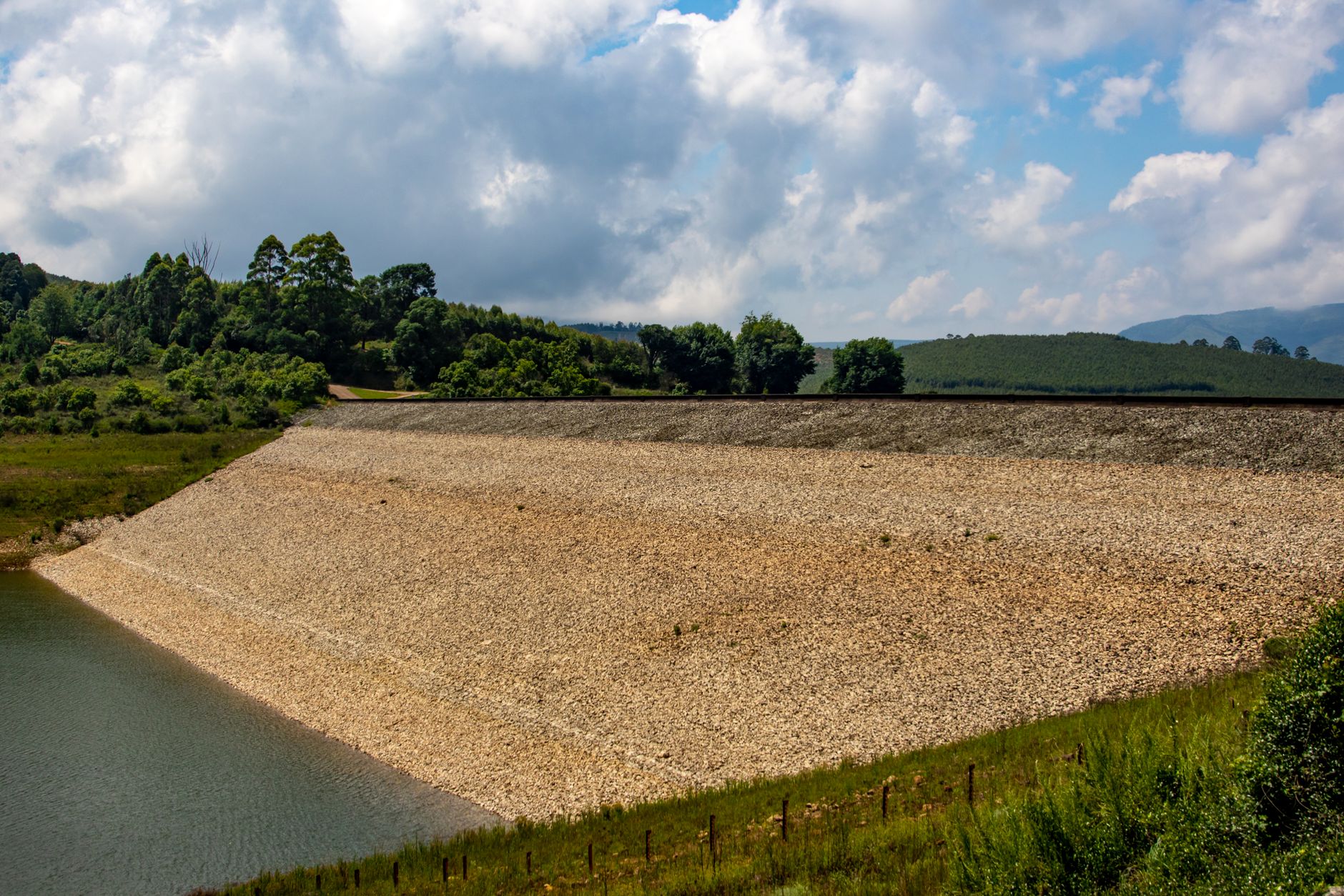
Our copper tailings embankment near Elko, Nevada gets walked every spring after the melt, and seepage spots are easy to miss on foot; could drones fly the crest and slopes and flag wet patches before anyone steps onto the dam?
Key takeaways
- A drone can flag candidate wet patches on the crest and slopes, but it cannot confirm seepage without a foot or instrument check.
- A levee field test found daytime infrared detection did worse than visible light, so plan thermal passes separately and test them first.
- Elko's snowy season runs to about April 17 on average, so schedule post-melt flights after the embankment is clear.
- Most drone flights must stay in visual line of sight unless you hold an FAA waiver, and the BVLOS rule is still pending.
- Use the same flight pattern and altitude every spring, and keep a record of which flags turned out to be real.
Can a drone flag seepage on an Elko tailings embankment?
Yes, a drone can fly the crest and slopes of an Elko tailings embankment and flag wet patches before anyone steps onto the dam. That is the job it does well. It produces a list of candidate spots for a person to check, rather than replacing the walk entirely. The drone's picture is a starting list, not a verdict on seepage, and treating it as a verdict is the mistake to avoid.
A useful version of this plan has three parts. A pilot flies a fixed pattern over the crest, the upstream and downstream slopes and the toe once the snow has cleared. Thermal and visible imagery from the same pattern are compared, and each flagged patch is located on a map. A trained engineer then walks to the flagged spots, checks them against past records and uses instruments where the dam design calls for it.
Expect the drone to miss some things too. Foot walks miss seepage as well, especially where wet ground sits under grass, in shadow or under thin fresh snow. The value of the flight is that it moves attention to where the image says to look, and it creates a repeatable record that shows change from one spring to the next.
What does Elko's snow season mean for a post-melt walk?
Elko gets a lot of winter snow. According to the Wikipedia summary of 1991 to 2020 climate normals, Elko Regional Airport averages about 41.2 inches of snow a year. Monthly averages run 10.4 inches in January, 6.8 inches in February, 5.5 inches in March, 3.3 inches in April and 0.4 inches in May, with no snow from June through September. Those are airport figures, so the snowpack on your embankment will not match them exactly.
The snowy season ends in spring. WeatherSpark puts it at early November to about April 17, after which snowfall is essentially absent. That gives a practical window, but it is a snowfall date, not a melt date. Snow can linger on shaded slopes and on the crest's north side after the last storm, so fly once the embankment is actually clear of snow, not on the first warm afternoon.
I could not verify melt-runoff or peak-melt dates for Elko from the sources I found, so do not treat any date here as your melt timing. Set the flight window from your own snow pillow, weather station and site records. Elevation and aspect also change the picture, because snow totals in the area are not uniform across the terrain.
How well do drones spot seepage on a tailings dam?
The research is encouraging but narrow. In a field test published in Scientific Reports in October 2024, a commercial drone with a thermal camera flew a leaking levee. The study found that daytime infrared detection did worse than visible-light detection, and that flight altitude noticeably affected accuracy. It was a levee, not a tailings dam, so read it as a method test rather than a promise of performance on your embankment.
False positives are the common problem. An ISPRS Annals paper from 2025 reports that vegetation, complex surface textures and uneven lighting can cause many false positives when a survey relies only on infrared and visible images. The same paper argues that thermal-infrared approaches face cost, weather dependency and deployment limits. Those are the conditions a tailings embankment is likely to present, with grass on the slopes, rock fill and changing sun angles.
Research on dam hazards is moving toward more specific failure modes. A 2026 ISPRS Archives paper describes a drone method that uses thermal saliency detection and adaptive thresholds to find dam piping, which is a seepage failure mode. That is a research method, so confirm what is commercially available before you plan a program around it. For now, the defensible approach is to use drone imagery to prioritize the walk and to keep the engineer's judgment in charge of what counts as seepage.
- Coverage per pass
Drone
Flies a fixed pattern over the crest and slopes, limited by line of sight and battery time
Staff
Walks the crest and slopes at a pace set by terrain, with close views of the toe and abutments
- Finding wet ground
Drone
Flags candidate wet patches from thermal and visible imagery, with false positives from vegetation and lighting
Staff
Sees wet ground, soft spots and seep flow up close and can test what the image suggests
- Daytime thermal reliability
Drone
Daytime infrared did worse than visible light in a levee field test, so thermal passes need separate checks
Staff
Judges wet ground by sight, touch and experience, though sun glare and snow cover can hide spots
- Worker exposure
Drone
No one stands on the embankment during the flight
Staff
A walker stands on the embankment, with fall and slip risk on wet or icy surfaces
- Records across seasons
Drone
Repeat patterns support image comparison from one spring to the next, if altitude and timing stay fixed
Staff
Notes and photos are only as consistent as the walker's habits
- Where the person wins
Drone
Cannot confirm seepage, measure flow or read instruments
Staff
Confirms or rejects each flag, judges what it means and decides the response
Can a drone fly the crest and slopes under FAA rules?
Drone flights over a dam are governed by FAA rules, and the picture is changing. Under Part 107, a drone weighs no more than 55 pounds, and flights beyond visual line of sight, called BVLOS, currently run only under waivers. A proposed rule would allow drones up to 1,320 pounds to fly BVLOS. According to Unmanned Aerial Online's September 2026 coverage, the FAA's Part 108 BVLOS final rule was sent to the White House review office on July 10, 2026, and in the latest update I found, from early October 2026, it was still under review with no publication date.
For a crest and slope survey, the practical question is whether your pilot can keep the aircraft in visual line of sight for the whole pattern. A long embankment with curves, or a far abutment hidden by terrain, can push a flight past that line. If it does, you need a waiver, and a waiver is an approval step that takes planning time, not a same-day fix. Build the schedule around that lead time.
Ask any operator how they plan to cover the dam within current rules, and get the flight plan and approval documents in writing. Because the rule is changing, a plan that works under Part 107 today should be reviewed when the final Part 108 rule is published, since the aircraft size limits and BVLOS permissions could change what is practical.
What do Nevada dam rules require for inspection records?
Nevada regulates dam safety through the Nevada Division of Water Resources. According to NDWR, it regulates dams at least 20 feet high or holding at least 20 acre-feet, to protect life and property, and it runs periodic visual inspections. A conference paper on Nevada tailings reports that the state has over 30 active permitted tailings dams under NDWR, so your embankment may be one of many the agency tracks.
Under NAC 535.360, the state engineer must send the operator a copy of each safety inspection report, and the regulation covers required repairs. The excerpt I reviewed did not give an inspection frequency, so confirm the interval with NDWR for your permit rather than relying on any number from this page. The inspection cadence in your permit governs your schedule, not a generic guideline.
A drone survey does not replace the state inspection, and it does not change what the report must contain. It can supply imagery that supports the engineer's findings, particularly when flights repeat the same pattern each spring. Keep the flight logs, the image sets and the reviewer's notes with the dam file, so that a reviewer can trace each flagged spot to a decision.
Who in Elko can fly and review drone imagery?

Elko County's job base is growing, but it is not deep in specialized roles. According to a Nevada GOED county profile from August 2025, county jobs rose 6.7 percent from 2020 to 2025, from 22,945 to 24,491. That profile counts total employment only, with no mining breakout, so it does not tell you how many people in the county do work like yours.
The staffing question for a drone program is narrower than the county figure. You need one or two people who can fly a planned pattern under your approval, and at least one trained reviewer who can read thermal and visible imagery without calling every warm patch a seep. Plan for coverage gaps too, because a pilot who is away during the melt window leaves the survey undone for the season.
Write down who owns the flight, who reviews the images and who signs off on the flagged list, and put that into the dam's inspection procedure. A program that depends on a single person fails the first time that person is out. Cross-training two people is cheaper than explaining a missed survey to a regulator.
How would a drone fit into a spring inspection routine?
A practical spring routine has four stages. Before the melt, record a baseline flight over the crest and slopes, so you have a clean reference set. After the snow clears, fly the same pattern at the same altitude, at the time of day your own sensor tests showed gives the clearest contrast. Compare the two sets and mark every candidate wet patch with its location on the dam map.
Then send people to the marked spots rather than around the whole dam. A walker with a list finishes the check faster than a walker on a general route, and the foot check can confirm, reject or escalate each flag. Anything that looks like flowing water, a new soft zone or a change from the baseline goes to the engineer the same day, with photos and coordinates.
Keep a record of every flag and its outcome. Over several springs, that record shows which types of flags turned out to be real, which were vegetation or lighting, and whether the sensor needs a different altitude or time of day. The levee study's finding that altitude affected accuracy is the reason to hold flight height fixed across seasons, so that year-to-year changes reflect the dam rather than the flight.
When is a drone the wrong choice for this dam?
A drone is not the right tool in every case. If the embankment is long and the pattern needs many line-of-sight breaks, a single pilot may not cover it within one spring window. If you only need one survey a year and have no internal flying capacity, a contracted survey may be the simpler start, and it lets you test the value before you commit to a lease.
Other cases are poorer fits. If your concern is a known seep that needs instrument monitoring, a drone adds an image to the record but does not measure flow or pressure change. If the melt is so variable that the window is hard to set, or cold conditions stop flying for long stretches, a drone adds cost without reducing the walk. Be candid about these limits before any site assessment.
The sensible test is one supervised spring survey, flown over a known seep and a known dry section and compared against your foot records. If the flags match what the walk found and the false positives are manageable, the case for a longer program gets stronger. If they do not, you have learned that cheaply.
How do you lease a drone for a dam inspection?
We lease drones through financing programs, so you do not need upfront capital to start, and the lease is quoted after a free site assessment. For a dam like yours, the assessment maps the embankment, notes the line-of-sight limits, checks the flight window against your melt records and defines the flag-and-verify workflow your team would use.
After the quote, we deploy the aircraft, set up flight plans under your approval, train the pilot and reviewers, and support the first live season. Service runs under a service plan that covers maintenance and repair, with spare unit coverage if an aircraft is down during the melt. One partner handles the whole lifecycle, so you are not coordinating a sensor vendor, a flight planner and a repair shop separately.
Ask any provider the same questions: which flight approval covers the dam, what the imagery workflow is, who reviews the images and how flags are recorded. A good answer is specific about the limits, including the parts of the walk that stay on foot.
Frequently asked questions
Upcoming events in Nevada
No events are listed in Elko yet. These are elsewhere in Nevada.
Put a robot to work in Elko.
We walk your site, learn the job, and recommend the unit that fits. Then we quote the lease, deploy it, and keep it serviced.